Companies in many industries are adopting drones, also known as unmanned aerial vehicles (UAV), for industrial asset management and inspections, especially in industries where maintenance procedures call for visual asset inspections.
By performing drone inspections, companies save time and cost while keeping employees safer and ensuring that assets function efficiently and failures don't hurt the bottom line.
This blog post will dive into four drone inspection use cases where high-fidelity computer vision data is collected.
We'll examine these four use cases that improve industrial inspections using drones:
- Inspecting power lines and utility poles
- Inspecting telecommunication towers
- Inspecting oil and gas pipelines
- Inspecting bridges
Once processed and expertly labeled, this high-quality data helps companies perform advanced data analytics leading to safe, accurate, and efficient inspections. This data trains computer vision models to create digital twins for predictive maintenance and industrial asset management.
1. Inspecting Power Lines and Utility Poles
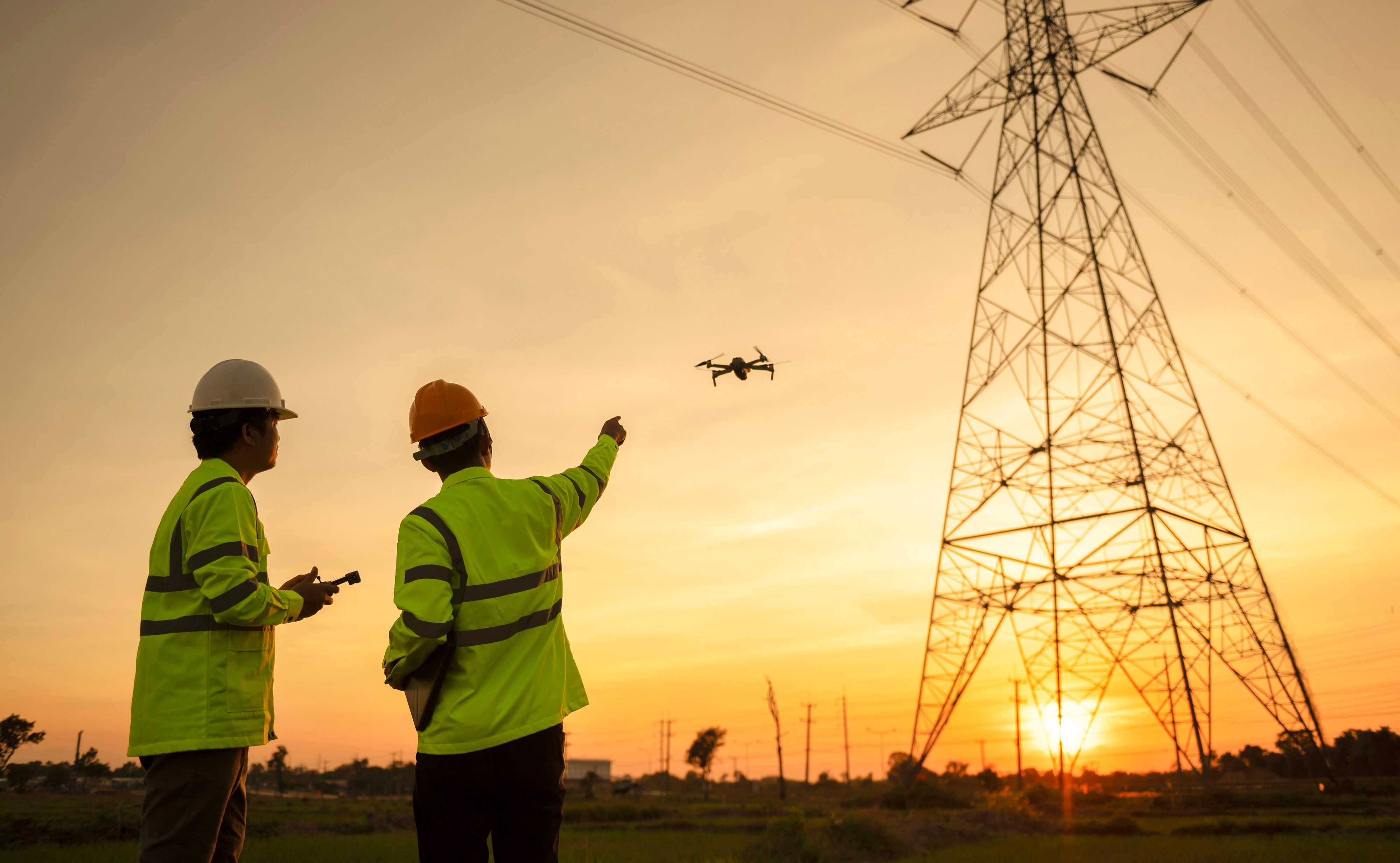
Power line and utility pole inspections are usually done on foot, by vehicle, or in a helicopter, but ground-based inspections can be slow and risky. If an inspector suspects a problem, they may need a lift vehicle, which is expensive and dangerous. In rural areas, rough terrain makes walking or driving difficult. Helicopter inspections are limited, hard to schedule, and even more costly.
A single power-line inspection by helicopter can cost over $9,000 a day. Buying a helicopter can cost over $2 million. Buying a drone and conducting drone inspections is much more cost-effective than investing in a helicopter.
Drones offer a quieter, cleaner, cheaper power line and utility pole inspection option. They’re also much safer because drones are unmanned; no one needs to be inside the drone flying at low altitudes parallel to electrified power lines and poles.
Drone inspection of power lines and poles can use cameras, LiDAR, color (RGB), hyperspectral and thermal imagery sensors to quickly canvas the area and collect data that would otherwise require workers to traverse potentially hazardous working conditions.
These millions of data points create 3-D images and give inspectors a highly accurate snapshot of power lines and poles. Also, a drone inspects power lines and utility poles from an overhead view, where most power lines and pole damage tend to be. These overhead views give inspectors a much clearer picture of potential damages, ultimately keeping them safer and limiting the times they need to go up in a mechanical lift
PrecisionHawk uses AI-enabled drones with failsafe features that enable the drone to fly low and slow to capture rich RGB and LiDAR data from various angles. Utility companies can then track power lines and pole changes over time and plan repairs and renovations.
Utility innovator, LineVision, has successfully demonstrated the value of using aerial data for power transmission maintenance by creating digital twins to monitor real-time dynamic line ratings.
2. Inspecting Oil and Gas Pipelines
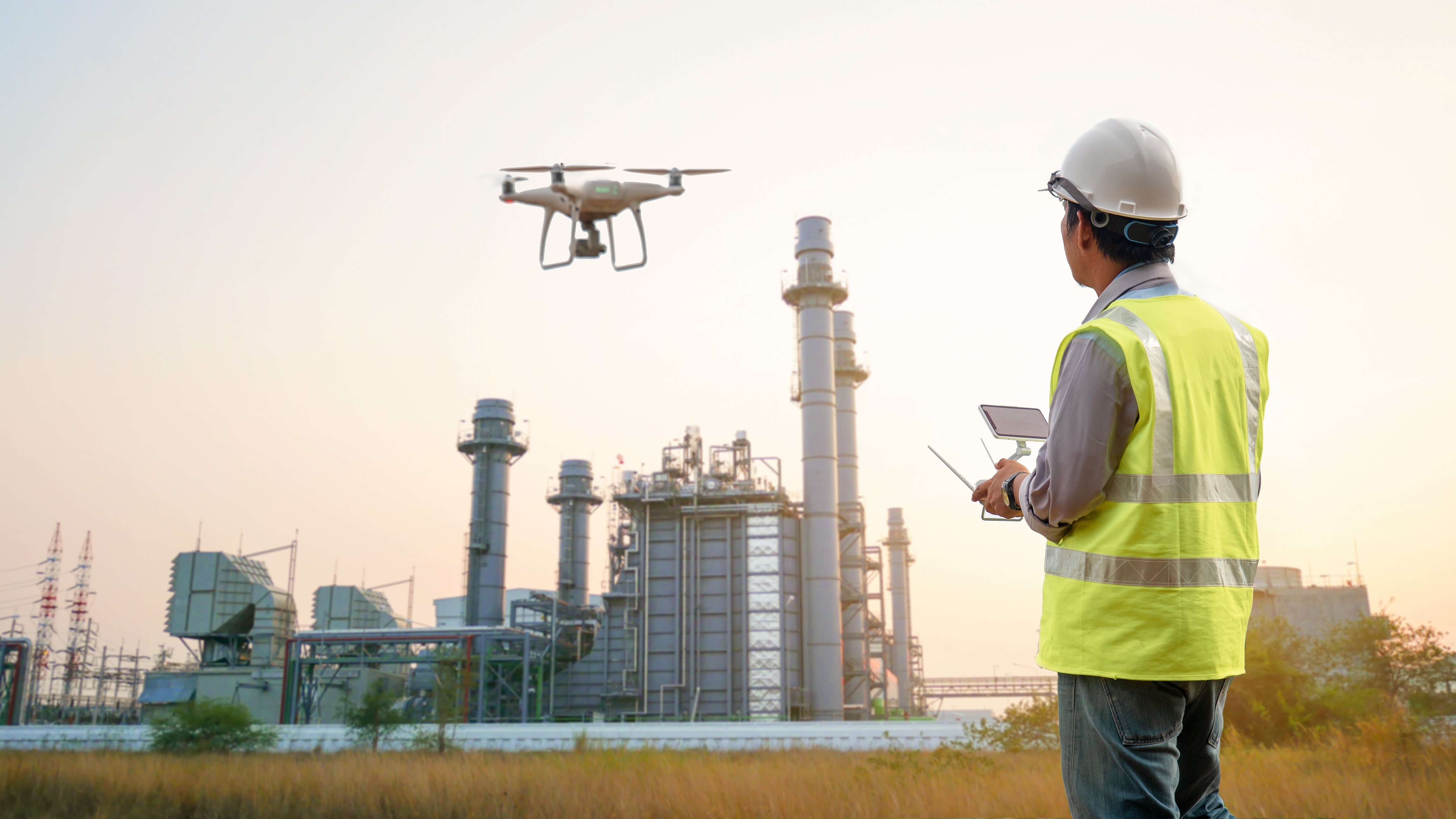
Oil and gas pipelines need regular inspections to avoid breaks, holes, cracks, and bending. Usually, inspectors have to stop the whole facility and check the pipelines on foot, by car, or by helicopter. They take pictures and notes and inspect many different parts of the pipeline. Inspectors also check how deep and straight the trenches are and if any rocks or debris might harm the pipeline.
An inspector may also collect data on the surrounding area for possible corrosion factors. These traditional pipeline inspections are challenging because of the need to inspect the vast distribution networks and varied terrain these pipelines often pass through.
Adding advanced data analytics, post-processing, and autonomy to drones for pipeline inspection is a non-intrusive method for inspections. The drones can inspect large areas of the network over various terrains and reach areas that are not accessible by humans.
Also, pipeline operations do not need to be shut down for a drone inspection, increasing uptime for the business. Drones use a variety of sensors and cameras to gather data that will indicate if there is physical or mechanical damage, corrosion, equipment defects, or natural conditions that could lead to pipeline failure.
Sharper Shape uses AI-based high-resolution image, video, and thermal cameras, combined with LiDAR and other sensors to provide a faster, safer, more accurate, and cost-effective data collection solution for many oil and gas inspections, including pipelines.
Their autonomous capabilities enable automated flight paths and custom data-capture profiles for individual structures. Detect and avoid technology helps their drones avoid obstructions, and in emergency events, a drone can be immediately deployed for automated damage assessment, minimizing risk to personnel.
Energy innovator, Abyss Solutions, has demonstrated how autonomous inspections using computer vision data can achieve a 50% inspection budget reduction, reduce risk during maintenance, and improve asset uptime in the process.
3. Inspecting Telecommunication Towers
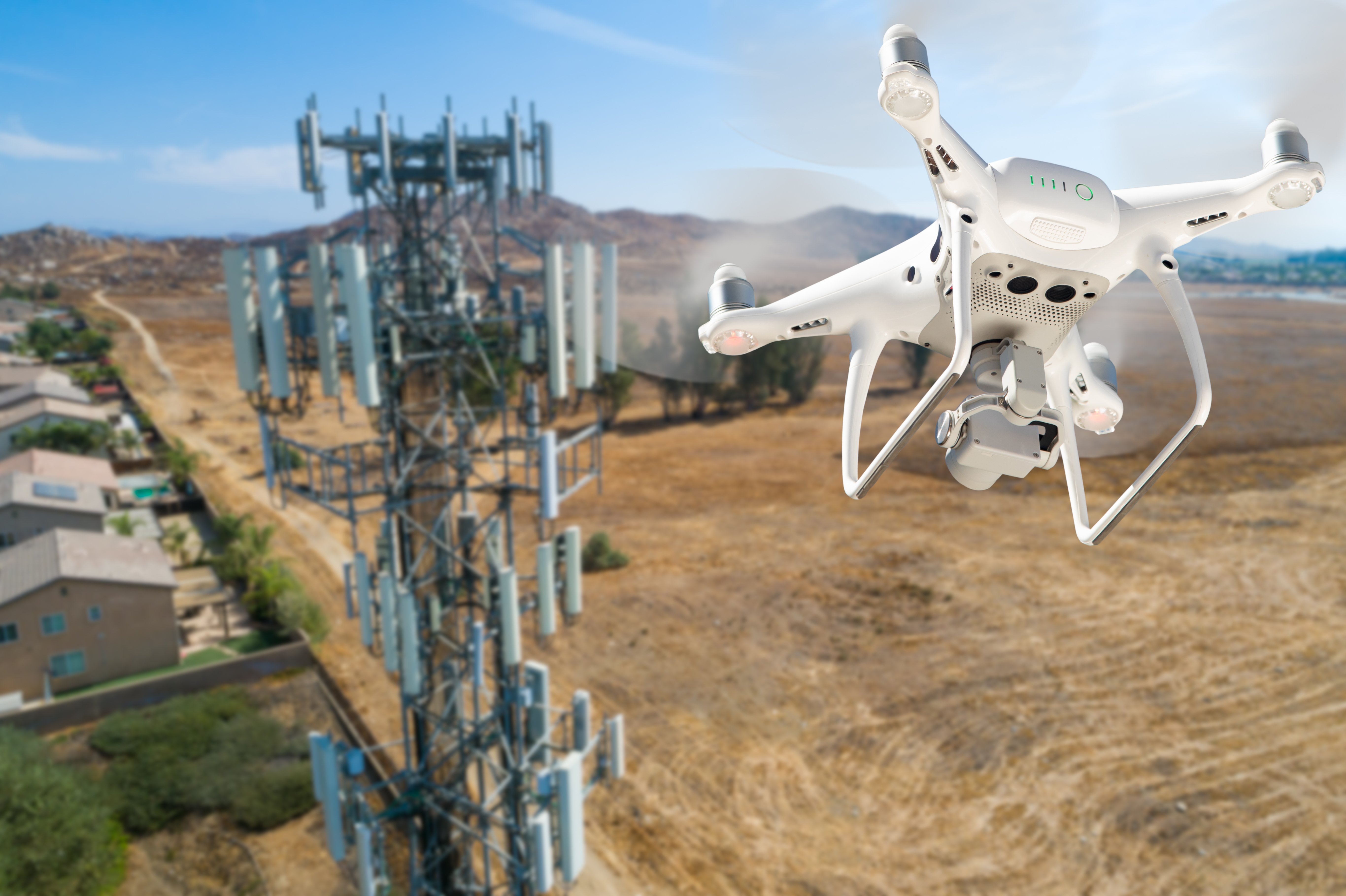
Telecommunications has become a vital "lifeline" service, connecting nearly 7 billion mobile users worldwide. But the underlying infrastructure supporting these services often goes unnoticed until adverse weather conditions impact it.
When severe weather strikes, it can cause significant damage to telecom towers, resulting in service disruptions that may last for days, leaving people acutely aware of their dependence on these systems.
Recently drones have become a valuable tool for rapid response teams, providing timely assessments of damaged towers and enabling triage to prioritize repairs. But the benefits of drones for telecom tower inspection go beyond just disaster response.
Free-standing towers hosting multiple cellular and microwave radio equipment hundreds of feet above ground pose significant safety risks and require expensive, time-consuming access for installers, inspectors, and repair technicians.
Drones now offer a safer, more efficient alternative by capturing detailed 3-D lidar point clouds to create highly accurate digital twins of telecom towers, facilitating pre-site surveys, assessing tower real estate, and asset verification. Asset and inventory management are now made much easier with these detailed digital inventories on a per-tower basis.
Preventative maintenance also benefits from drone inspections, as high-resolution cameras detect rust and corrosion on towers and mounting devices, allowing for scheduled repairs ahead of failure.
With drones, tower inspections that once were a risky, time-consuming task can now be completed safely in under an hour with a single drone operator.
4. Inspecting Bridges
According to Market Screener, 42% of American bridges are over 50 years old and require regular inspections to ensure their structural health. Conventional bridge inspections are usually performed using a snooper truck. A snooper truck is considered dangerous because it can critically injure or even kill crew members when they malfunction. Traditional bridge inspections are also costly, and those costs increase significantly if interruptions occur because of problems with lane closures and traffic on the bridge.
To combat rising costs, bridge inspection companies are investing more and more in AI-enabled drones as an alternative solution for conducting inspections. According to GIM International, drones are up to 75% cheaper to operate than manual inspections, do not affect traffic flow, and are environmentally friendly. In bridge inspections, drones use AI-enabled sensors to efficiently capture and localize critical information such as defects or maintenance issues while safely navigating complex, GPS-denied environments using detect and avoid technology.
Skydio is one company heavily invested in AI-enabled drones for bridge inspections. The North Carolina Department of Transportation received the first-of-its-kind, state-wide FAA beyond visual line of sight (BVLOS) approval to inspect bridges using Skydio drones. The company conducts BVLOS drone inspections that enable workers to inspect more expansive areas, larger structures, and dangerous or difficult-to-reach environments while reducing visual observer and surveillance costs.
Drones create digital twins of bridges
Another exciting way drones can help preserve structural health is by gathering the large amount of data needed to create digital twins, a digital representation of a physical asset that allows its performance to be understood and modeled.
According to a 2021 article from MDPI, “Digital twins are suitable alternatives to in-person and on-site based assessments that can provide safer, cheaper, more reliable, and less disruptive bridge inspections.” A digital twin combines data from continuous surveys, photogrammetry, LiDAR, and other sensors to track changes to a bridge over time.
This enables owners to view the digital representation of the bridge and related real-world conditions over time to track and understand information, such as the exact size of cracking, corrosion, or section loss, rather than trying to determine this information by manual inspections.
Bentley creates digital twins to help inspectors inspect large areas of a bridge while in the office. This reduces the time spent in the field, which saves time and money and increases safety. Digital twins also give inspectors flexibility to conduct more in-depth inspections without scheduling expensive equipment and labor.
Drone inspections are here to stay
These four use cases represent a tiny sample of how drones gather and use data to improve inspections.
The proper post-processing of data and quality image annotation are critical steps in preparing the enormous amount of data inspectors require to inspect assets properly. In addition, there is no room for error when it comes to the data that improves drone inspections, as inaccurate data can lead to erroneous reporting, wasted time and money, and injury or damage to assets, property, or humans.
Drones are also becoming popular in other industries, including construction, real estate, insurance, renewable energy, and manufacturing. Regardless of the industry, using drones to collect data will improve safety, reduce costs, and enhance insights from inspections.
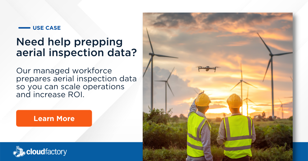
How CloudFactory can help you gain valuable insights from your drone inspection data
Quality inputs yield quality outputs, which is why extracting valuable insights from data collected by drones and terrestrial systems begins with quality data processing and annotation. CloudFactory’s managed human-in-the-loop workforce has expertise in labeling 2-D and 3-D images and video, sensor, point cloud, orthomosaic, digital twin, and LiDAR data, so your team can gain valuable insights quickly while optimizing your operational costs.
In addition, our recently launched Accelerated Annotation, an AI-assisted labeling solution for 2-D images, learns and adapts to your use case to improve annotation speed and quality. This product blends the best AI-powered automation and human expertise to deliver accurate labels for image datasets 5x faster.
Learn more about how CloudFactory prepares aerial inspection data so you can scale operations and improve asset management.
Data Labeling Training Data Computer Vision AI & Machine Learning Drones
