Geospatial technology is quickly carrying humanity to the crossroads of past and present—a past where dreams of zipping through the futuristic skies of George Jetson’s Orbit City, and playing the flute with Captain Jean-Luc Picard in the Star Trek holodeck, meets the present state of smart cities, virtual reality, and so much more. Companies using geospatial tech are mapping the world, giving us the ability to analyze the reach and impact of human activity at a scale unheard of before.
As the demand for geospatial products and services grows, companies in the burgeoning space face the challenge of turning mountains of complex data types, such as LiDAR and satellite imagery, into datasets useful for AI and geospatial information system solutions. Extracting intelligence by labeling geospatial data is a complex and nuanced process requiring high levels of precision, accuracy, and quality control. Scaling the process can be even harder.
In this post, you’ll get a glimpse into the complex world of geospatial data labeling from our perspective, with examples and resources to guide you as you enter, expand, and excel in the space.
#1. LiDAR
LiDAR, which stands for light detection and ranging, is one of the most important geospatial technologies for the advancement of the autonomous vehicle market. LiDAR measures variable distances from a receiver to objects above, below, and around the receiver. In the case of autonomous vehicles, multiple receivers sit on a vehicle and scan the surrounding area to let the vehicle know where obstacles and other objects are at all times. It sounds easy, in theory. But for a vehicle to interpret the dynamic world around it first requires—among many other things—the meticulous labeling of 360-degree images captured by multi-sensor LiDAR cameras.
LiDAR use cases extend beyond autonomous vehicles, too. According to ABI Research, the coming decades will see LiDAR usage growing in the security, smart cities, and industrial automation markets as well. One of our clients, a software company headquartered in the United States, is using LiDAR to develop high-definition mapping for infrastructure, mobility, and transportation through 3D data aggregation. To that end, CloudFactory data analysts label more than 1,000 time-based images per hour at greater than 99% accuracy. They also perform LiDAR feature extraction and conduct quality assurance on the client’s model outputs.
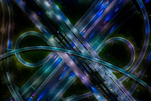
LiDAR use cases will extend beyond autonomous vehicles into IoT markets such as transportation.
#2. Smart infrastructure
Data labeling is a complex undertaking for smart technology systems as well. Consider the multitude of applications for spatial mapping data, such as the data available through EarthData, a service of NASA’s Earth Science Data and Information System. EarthData’s open-access spatial data can be combined with, for example, a water utility’s GIS to map and maintain a region’s pipes and other assets.
Layer on to such open-source datasets even more geospatial data, such as the data captured by drones, and smart cities gain access to information that supports citizen security, infrastructure planning, and traffic safety. The city of Nanjing, China uses geospatial technologies to gather data and help city leaders and citizens keep tabs on the more than one million cars, 7,000 buses, and 10,000 taxis jamming their roads. This type of monitoring combined with smart infrastructure practices will pave the way for autonomous vehicles to become mainstream.
Geospatial data is the driving force behind the smart technology revolution—and there is a lot of it. GeoPlatform.gov, home of the United States’ Geospatial Platform, a source of authoritative, geographically enriched data, hosts more than 60,000 datasets covering topics from boundaries to farming to oceans, all publicly available to help the world become a better place through knowledge sharing.
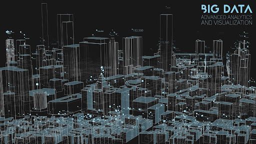
Complex geospatial data showing an abstract social sorting visualization
#3. Mapping-as-a-service
In 1832, French cartographer Charles Picquet created the earliest known example of a geospatial map, illustrating how many people died of cholera in each of Paris’ 48 districts. Geospatial mapping has come a long way since then; today, the technology powers the rapidly growing on-demand mapping industry, which offers a cost-effective way for companies to acquire geospatial data. Geospatial companies growing quickly may need not only traditional data labeling, but also a scalable solution that ramps up and down with fluctuations in demand.
In some cases, labeling mapping data requires domain-specific expertise. For example, polygonal annotation outlines target objects, such as buildings, by their exact edges, regardless of their shape. In other use cases, images need to be segmented to differentiate between different plots of land or by crop types in fields. Other projects might require the annotation of specific points of interest.
Some use cases are even more specific. After delivering more than 300,000 hours of annotation work over a three-year period, CloudFactory helped Nearmap scaled aerial data labeling for roof geometry. One of the 10 largest aerial survey companies in the world by annual data collection volume, Nearmap helps thousands of users every day conduct virtual site visits to gain deep, data-driven insights and to tell stories through visualized context.
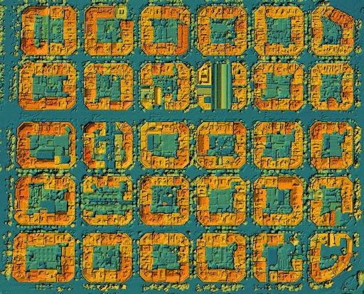
Digital elevation model showing city a LiDAR scanned urban area with roads and junctions between dense blocks
Quality control—the secret to geospatial data labeling at scale
Most companies outsource geospatial data labeling to overcome the challenge of scale. But then a new challenge arises—maintaining quality control. Domain expertise, the proper training, and attention to detail are critical here, as are the annotation tools you use to complete labeling tasks. If the chosen tool is improper, or even less than ideal, data analysts will struggle to complete labeling tasks, and the quality of the data will suffer. Even worse, labeling errors in one dataset can seep throughout a system, leading to imprecision, and poor machine learning and artificial intelligence models, and making real the saying, “Garbage in, garbage out.” That’s why, at CloudFactory, quality is not just a goal. It is a mindset. Our workflow approach includes a detailed quality assurance process that helps us identify and resolve issues before sending the work back to you.
Some companies prefer to build an in-house team to handle the quality control aspect of geospatial data labeling, but doing so takes time and money and ability to scale up and down with the ebbs and flows in your data pipeline. Another option is to partner with a fully managed workforce that acts as an extension of your team. You retain control over the direction and quality of the project, and boost your speed to market without the risks involved in hiring crowdsourced workers.
Our managed workforce helps you scale geospatial data labeling to meet the high demands of speed and accuracy in real-time applications. Speak to our experts today to learn more.
Data Labeling Computer Vision Image Annotation AI & Machine Learning
